EN
EN  PT_BR
PT_BR 
Weather models indicate that, starting this Friday (27), an episode of intense heat should hit a large part of Rio Grande do Sul, as well as areas in western Santa Catarina, Paraná and Mato Grosso do Sul. Temperatures may be up to 5 °C above average in isolated areas, and this pattern should persist, at least, until next Monday (30). In this sense, INMET does not rule out the possibility of the formation of a heat wave.
Initially, the highest temperatures will be observed in the central-eastern part of Rio Grande do Sul, expanding throughout the state. Over the next few days, the heat should intensify especially in the central-western part of Rio Grande do Sul, where, until Sunday (29), maximum temperatures may vary between 36 °C and 38 °C. In the central region, thermometers may register 36 °C. In Bagé and Uruguaiana, the maximum temperatures may reach around 34 °C to 35 °C.
Gradually, the heat will extend to other states in the Southern Region and to Mato Grosso do Sul, where maximum temperatures may reach 38 °C, especially in north-central areas. Figure 1 shows the maximum temperature anomaly for Sunday (29), with values around 7 °C above average.
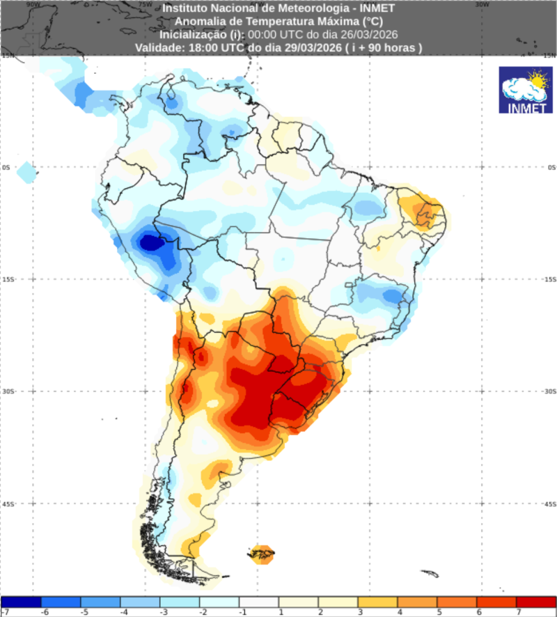
This heat wave is associated with the presence of a high-pressure system over the region, especially between March 27 and 30. This system hinders cloud formation, increasing the incidence of solar radiation and, consequently, raising temperatures. In areas of Rio Grande do Sul and Santa Catarina, the movement of this system will contribute to maintaining stable atmospheric conditions, sustaining this scenario until Monday (30), when the system begins to move away to the west, gradually reducing its influence and, consequently, the temperature anomalies.