EN
EN  PT_BR
PT_BR 

The arrival of a cold front in the Central-West region is expected to change the weather pattern in the coming days, especially in Mato Grosso do Sul. The system is moving through southern Brazil, bringing heavy rain to strategic agricultural areas of the state, and causing the first significant cold snap of the year in the region. The combination of precipitation and a sharp drop in temperatures requires attention from rural producers.
The highest rainfall totals are expected in municipalities in the southern part of Mato Grosso do Sul, particularly in Dourados, Rio Brilhante, Nova Alvorada do Sul, Maracaju, and Cidrolândia. In some locations, rainfall amounts could range between 40 and 60 millimeters on Saturday alone, a high level for May, a period marked by the transition to the dry season.
According to meteorologist Estael, Mato Grosso do Sul is directly influenced by the weather systems that move through the south of the country. "Mato Grosso do Sul and São Paulo end up experiencing more direct consequences than what happens in southern Brazil. Some of this humidity and instability remains," she explained during the meteorological analysis.
Rain benefits agricultural areas in the south of the state.
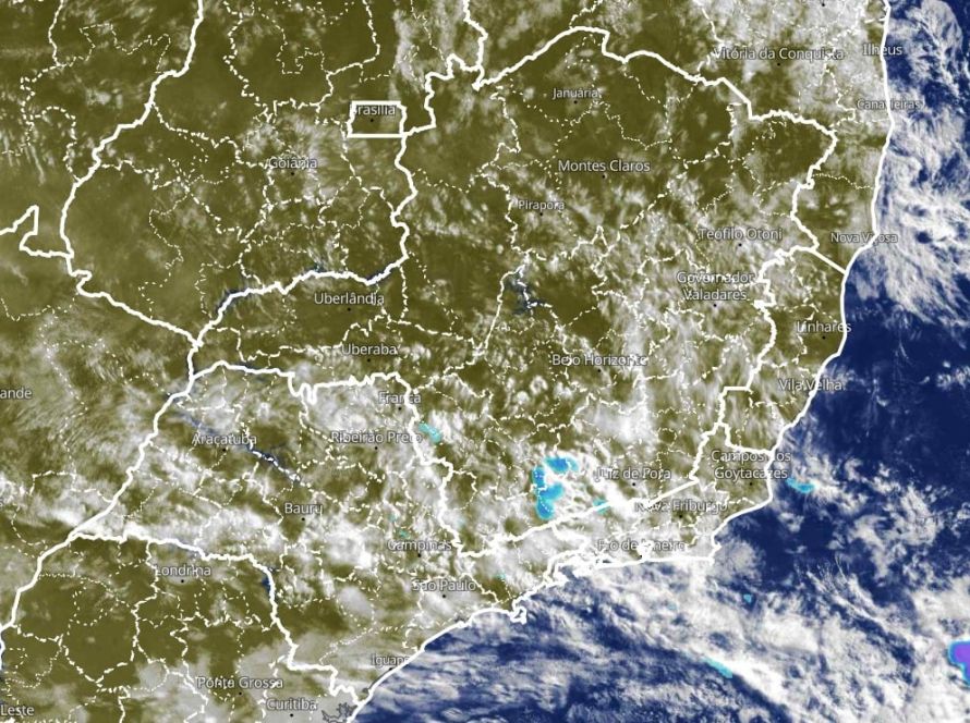
Weather maps indicate that rain is already affecting parts of southern Mato Grosso do Sul and is expected to advance throughout the weekend. The largest volumes are concentrated near the state's most productive agricultural frontier, an important region for soybeans, second-crop corn, and beef cattle farming.
“We are already seeing Dourados with accumulated rainfall between 40 and 50 millimeters, which is quite significant for May,” Estael highlighted. In areas near Vista Alegre, meteorological models indicate even higher volumes, potentially exceeding 60 millimeters in 24 hours.
In Campo Grande and neighboring municipalities, the forecast also indicates significant rainfall, between 15 and 20 millimeters. For the productive sector, the rain arrives at a strategic moment, helping to maintain soil moisture in areas that have faced a series of dry days and high temperatures.
Northern Central-West regions continue to experience dry weather.
While southern Mato Grosso do Sul accounts for the highest rainfall totals, the scenario changes completely in other areas of the Central-West region. Mato Grosso, Goiás, and the Federal District should continue to experience predominantly dry weather and low rainfall amounts.
According to the expert, the weekly rainfall accumulation maps show very irregular rainfall in these regions. "When we look at the predicted volumes for Mato Grosso and Goiás, the accumulations are very low, between 5 and 10 millimeters in five days, practically nothing for the crops," she stated.
The situation remains a concern, especially among producers who depend on moisture for second-crop plantings and pastures. In several locations in the Midwest, May already marks the beginning of a drier period with less frequent rainfall.
Cold snap brings down temperatures in Mato Grosso do Sul
In addition to the rain, the arrival of a cold air mass should cause a sharp drop in temperatures in the Midwest. Mato Grosso do Sul will once again be the most affected state, with lows close to 4 degrees Celsius between Monday and Tuesday.
"We could see temperatures between 4 and 6 degrees in municipalities like Dourados, Maracaju, Nova Alvorada do Sul, and Rio Brilhante," warned Estael. According to her, this is the first more intense cold snap of 2026 in the region.
The cooling trend is also advancing over Mato Grosso and southern Goiás, although with less intensity. In these areas, minimum temperatures should be close to 10 degrees Celsius, enough to cause an unusual feeling of cold after weeks of typical summer temperatures.
Climate change can affect field management.
The sharp drop in temperature can alter the management practices on agricultural and livestock farms. Crops that are more sensitive to cold require constant monitoring, especially in lowland areas, where cold air tends to concentrate during the early morning hours.
Despite the thermal impact, the meteorologist highlighted that the cold will be temporary. "This significant cooling period will last two to four days, especially in Mato Grosso do Sul," she explained. After that, temperatures will gradually rise again in most of the region.
For livestock farmers, the milder climate can improve the thermal comfort of the animals, but it requires attention to pastures and feed supplementation, especially on properties where the drought is already beginning to reduce the vigor of the grass.
Municipalities involved in agricultural production are under climate alert.
In Ivinhema, one of the municipalities monitored during the forecast, the accumulated rainfall could exceed 50 millimeters between Friday and Saturday. The forecast indicates more widespread precipitation during the afternoon and evening, followed by a sharp drop in temperature.
"On Monday, Ivinhema could wake up to a low of only 6 degrees and a high of 18 degrees," said Estael. This scenario represents a drastic change for a region accustomed to persistent heat at this time of year.
In Nova Mutum, Mato Grosso, the biggest impact will be on temperatures, not rainfall. The predicted high will drop from 33 to 22 degrees Celsius between Saturday and Sunday, while dry weather is expected to continue to prevail for almost the entire next week.
Producers should monitor regional forecasts.
Experts recommend that producers monitor weather updates daily, especially in municipalities in southern Mato Grosso do Sul. The combination of heavy rain and intense cold can disrupt field operations, transportation, and animal handling.
Even without widespread frost forecasts in the Midwest, the more intense cold can generate localized effects in low-lying areas and properties more susceptible to temperature loss during the early morning hours.
The trend is for the weather system to weaken starting in the middle of next week. Even so, the coming days should mark one of the most significant changes in the region's weather pattern since the beginning of autumn.