EN
EN  PT_BR
PT_BR 
The weather conditions predicted for the last quarter of 2025, published in StoneX Quarterly Commodities Outlook ReportThey highlight the increasing likelihood of the La Niña phenomenon forming. This information comes from Carolina Jaramillo Giraldo, Market Intelligence analyst at the company.
According to the most recent data, sea surface temperature anomalies indicate cooling in the central and eastern Pacific regions (Niño 3.4 and Niño 3), accompanied by warming in the western Pacific, a typical La Niña configuration. "Reports from the World Meteorological Organization (WMO), the International Research Institute for Climate and Society (IRI), and the National Oceanic and Atmospheric Administration (NOAA) point to a weak La Niña, although the possibility of a return to neutrality during the Southern Hemisphere summer cannot be ruled out," notes the analyst.
Historically, the La Niña phenomenon usually lasts between three and four rolling quarters, but there are records of longer events. In 1984 and 2017, for example, the phenomenon began in the SON quarter (September–November) and extended for 11 and 6 quarters, respectively. Based on these precedents, there is a possibility that the current La Niña will last until the first months of 2026.
Global climate impacts
The typical atmospheric configuration of La Niña, marked by high pressure in the central and eastern Pacific and low pressure in the western Pacific, tends to influence weather patterns in various regions of the world. Projections indicate below-average rainfall in southern Europe, Central Asia, and eastern Africa, as well as localized dry anomalies in northern Mexico, southern Brazil, Uruguay, southwestern Argentina, and southern Chile. “Conversely, above-average rainfall is expected in areas such as India, northern Asia, Central America, Canada, the northern United States, and western Colombia. In southeastern Brazil and Bolivia, the signal is weaker and less consistent, while in the rest of the Americas, conditions tend to oscillate around normal,” points out Carolina.
Climate scenario in Brazil

StoneX Market Intelligence Analyst Carolina Jaramillo Giraldo explains that climate models indicate a higher probability of La Niña formation in the last quarter of 2025 – Photo: Press Release/StoneX
The winter of 2025 was marked by below-average temperatures, especially the maximum temperatures. For the coming months, climate models indicate temperatures close to normal, with significant regional variations. In October, eastern Mato Grosso, western Bahia, and part of northeastern Goiás may register temperatures up to +1°C above average, which accelerates soybean germination but also increases the risk of water deficit if rainfall is delayed.
In November, according to the analyst, the trend is for temperatures to be within the normal range in the Central-West, Cerrado, and South regions. In the Southeast, especially in Espírito Santo and east-central Minas Gerais, anomalies of up to +1 °C may occur, increasing evapotranspiration in crops and coffee plantations. Between December and January, the South-Central region should register average temperatures, favoring grain filling, provided there is good rainfall distribution. In the Northeast, some areas may have temperatures up to +1 °C above average, while in the North, January tends to be warmer than December, increasing pressure on crops.
Atmospheric telecommunications and agricultural risks
The interaction between La Niña and the Madden–Julian Oscillation (MJO), a pulse of tropical storms that moves from west to east in 30- to 60-day cycles, can intensify climatic effects in the Southern Hemisphere. When the MJO is positioned over Indonesia and the western Pacific during La Niña years, the extratropical atmosphere tends to respond with a positive Antarctic Oscillation (AAO) pattern.
As the analyst explains, this phenomenon shifts westerly winds to more southerly latitudes, reducing the entry of cold fronts into southern South America and favoring atmospheric blocking. "The result is an increase in drought and heat in regions such as southern Brazil, Paraguay, Uruguay, and Argentina, precisely during spring and summer, critical periods for crops like corn and first-crop soybeans," details Carolina Giraldo.
In the tropics, the scenario is contrasting: the interaction between La Niña and the MJO intensifies convection in the western Pacific, Indonesia, Southeast Asia, and the Philippines, resulting in more intense rainfall, while the central and eastern Pacific remains drier. In Central and Southeastern Brazil, above-average rainfall is expected, which may benefit crops such as soybeans, corn, and coffee, but may also harm sugarcane due to high cloud cover and increase the risk of fungal diseases due to recurring humidity.
Projections for the Pacific and economic implications

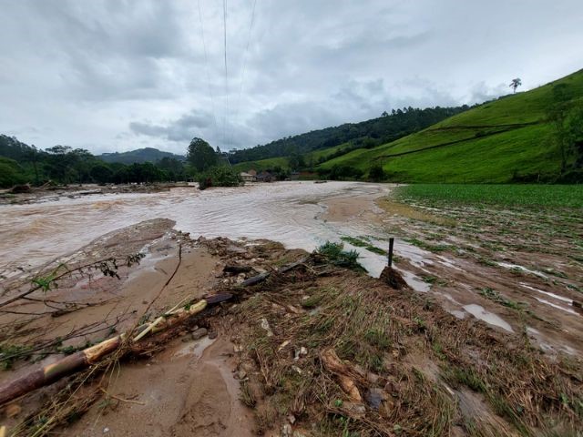
Photo: Antonio Carlos Mafalda
WMO precipitation forecasts for the OND quarter of 2025 in the Pacific are aligned with a positive east-west gradient of sea surface temperature, a pattern similar to that observed in moderate La Niña events, the expert highlights. The highest probabilities of above-average rainfall are concentrated in Southeast Asia, especially around the Philippines, with probabilities close to 70%. In the eastern half of Australia, the signal is weaker. “Between the central Pacific and the far East, the trend is for rainfall ranging from normal to slightly below average. North of the Equator, there is an indication of drought, which extends southeast towards the western coastal regions of South America,” Carolina points out.
Download the full StoneX Commodities Outlook report. here.