EN
EN  PT_BR
PT_BR 

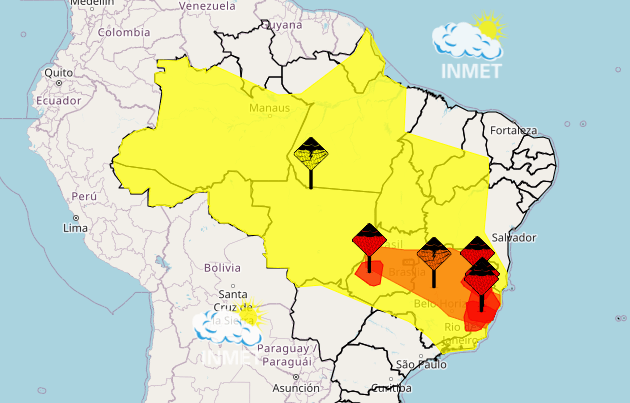
The National Institute of Meteorology (Inmet) published this Tuesday (16) the climate outlook until next Monday (22) for the whole of Brazil. This week should be marked by an atmospheric pattern typical of summer, with the organization of a moisture confluence channel that may evolve into a South Atlantic Convergence Zone (SACZ).
According to Inmet, this system is expected to move from northwest to southeast, favoring high volumes of rain in a corridor that extends from the North to the Southeast of the country, passing through the Midwest, over several consecutive days.
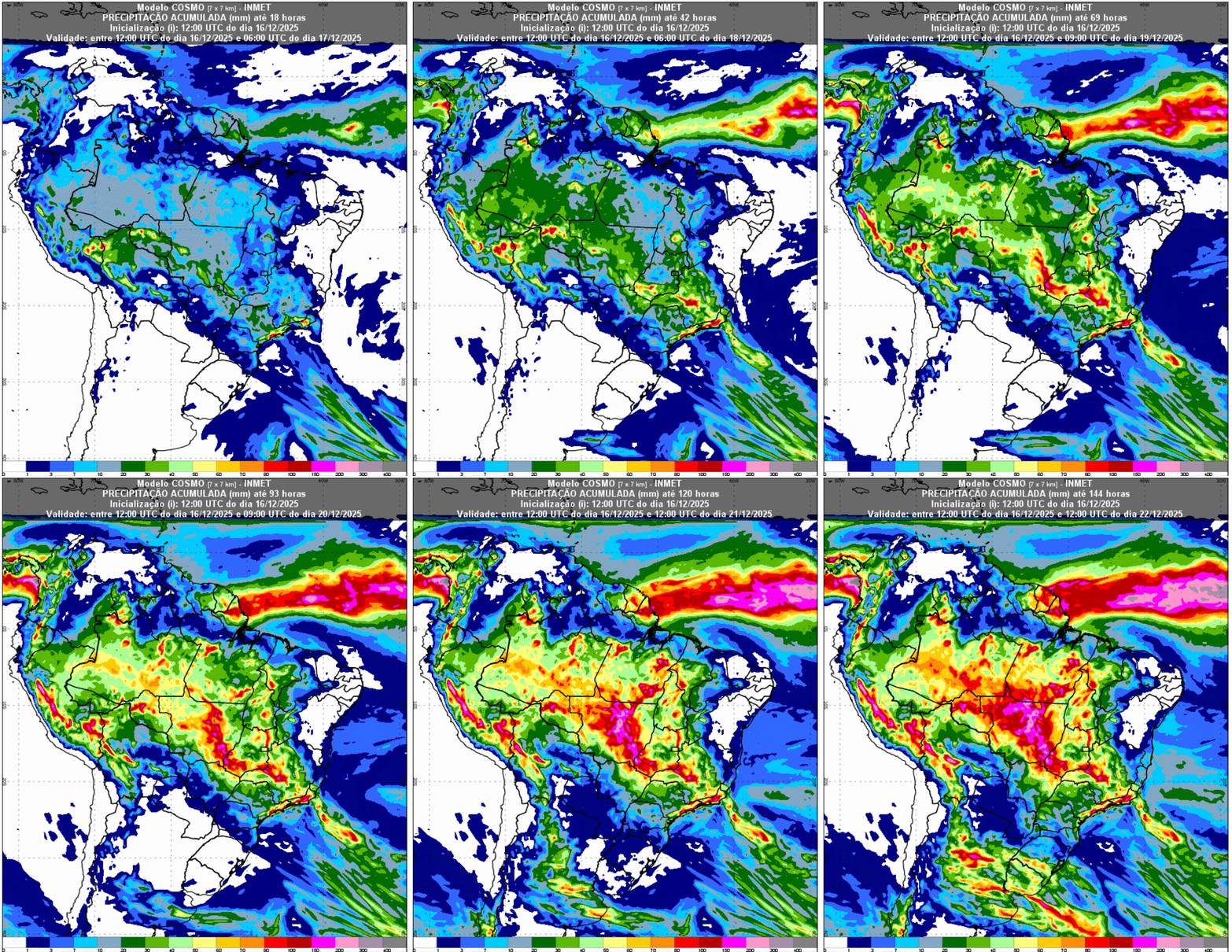
In the Central-West region, Inmet (National Institute of Meteorology) indicates a scenario requiring attention due to persistent and heavy rainfall, mainly in Mato Grosso and Goiás. The formation and maintenance of a moisture convergence channel should sustain frequent precipitation, with accumulations between 100 and 200 millimeters in areas of the three states in the region.
In northern Mato Grosso and southern Goiás, the rainfall amounts could be even higher. According to Inmet, the most critical period is concentrated between December 17th and 21st, when the downpours tend to be more intense and have the potential to cause disruption.
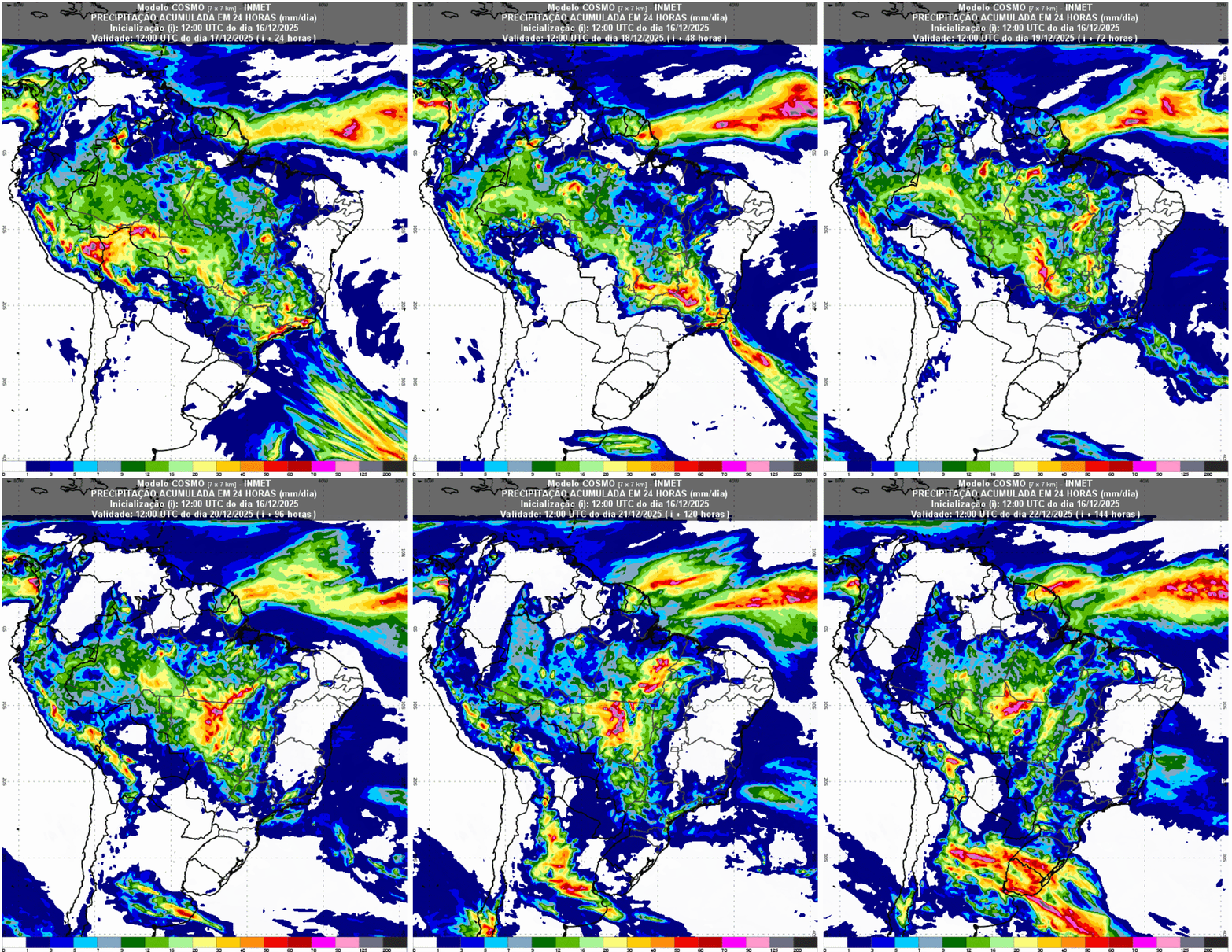
The 24-hour accumulated precipitation map shows rainfall starting at 20 millimeters in southern Goiás and southern Mato Grosso. Rainfall will intensify throughout the week, reaching around 100 millimeters in 24 hours over north-central Mato Grosso.
In Mato Grosso do Sul, although rain is forecast, the institute highlights less likelihood of large accumulations, with a relatively drier scenario. Relative humidity should remain high in most of the region, between 60% and 80%, decreasing to values close to 40% to 50% in western Mato Grosso do Sul.
In the Southeast region, information from Inmet indicates significant rainfall until at least December 18th in large areas of Minas Gerais and Rio de Janeiro, subsequently advancing towards southern Espírito Santo. The system's activity, combined with the passage of a cold front over the ocean, increases the risk of storms in regions such as the Paraíba Valley, Serra do Mar, Mantiqueira, southern and Triângulo Mineiro, as well as the mountainous region of Rio de Janeiro and a large part of the state of Rio de Janeiro.
In these locations, rainfall amounts could reach between 100 and 200 millimeters in up to 48 hours. In São Paulo and Espírito Santo, Inmet (National Institute of Meteorology) emphasizes that rainfall tends to be more isolated and with lower accumulations. Relative humidity should remain between 65% and 75% throughout the week, except in northern Minas Gerais, where it may drop to around 50%.
In the Northern Region, Inmet highlights the concentration of the heaviest rainfall over the Amazon, where the combination of heat, high moisture availability, and local atmospheric circulation favors the formation of persistent areas of instability.
The expected rainfall totals generally range between 60 and 150 millimeters, and may exceed this level in areas aligned with the moisture confluence channel. Northern Amapá should also register higher volumes, influenced by its proximity to the Intertropical Convergence Zone.
On the other hand, southern Amapá, northern Pará, and Roraima should face a week with little rain, limited to quick and localized episodes. According to Inmet, relative humidity will remain high in most of the region, above 60%, but may drop to levels between 30% and 40% in areas with less rainfall.
In the south of the country, the passage of a cold front should cause high accumulations in western Paraná and Rio Grande do Sul, with volumes that could exceed 100 millimeters in 24 hours. In Santa Catarina, there is still a chance of rain on the 17th, although with a tendency for reduced intensity as the system moves away.
From the second half of the week onwards, Inmet indicates a predominance of drier and more stable weather throughout the region. Relative humidity will remain high at the beginning of the period, around 70%, gradually decreasing to values between 40% and 50% in the following days.
In the Northeast, Inmet (National Institute of Meteorology) forecasts a week with predominantly dry weather in most states. The exceptions are northern Maranhão and Piauí, where isolated showers may occur from mid-week onwards, but with low accumulations. The institute draws attention to the low relative humidity levels, especially in the area encompassing Piauí, Ceará, Pernambuco, and Bahia, with values between 20% and 30% and the possibility of even lower levels, below 15%, between Pernambuco and northern Bahia. In the far west of Bahia, humidity tends to be higher, exceeding 50%, according to Inmet's projections.