EN
EN  PT_BR
PT_BR 

Heavy rains are expected to hit areas of the Midwest and Southeast in the coming days, particularly Goiás and Minas Gerais, with significant volumes expected in the North of the country and western Bahia, according to Inmet.
Rainfall maps indicate that the highest volumes of rain are expected to be concentrated between eastern Goiás and Minas Gerais, where accumulations could approach or exceed 100 millimeters throughout the week.
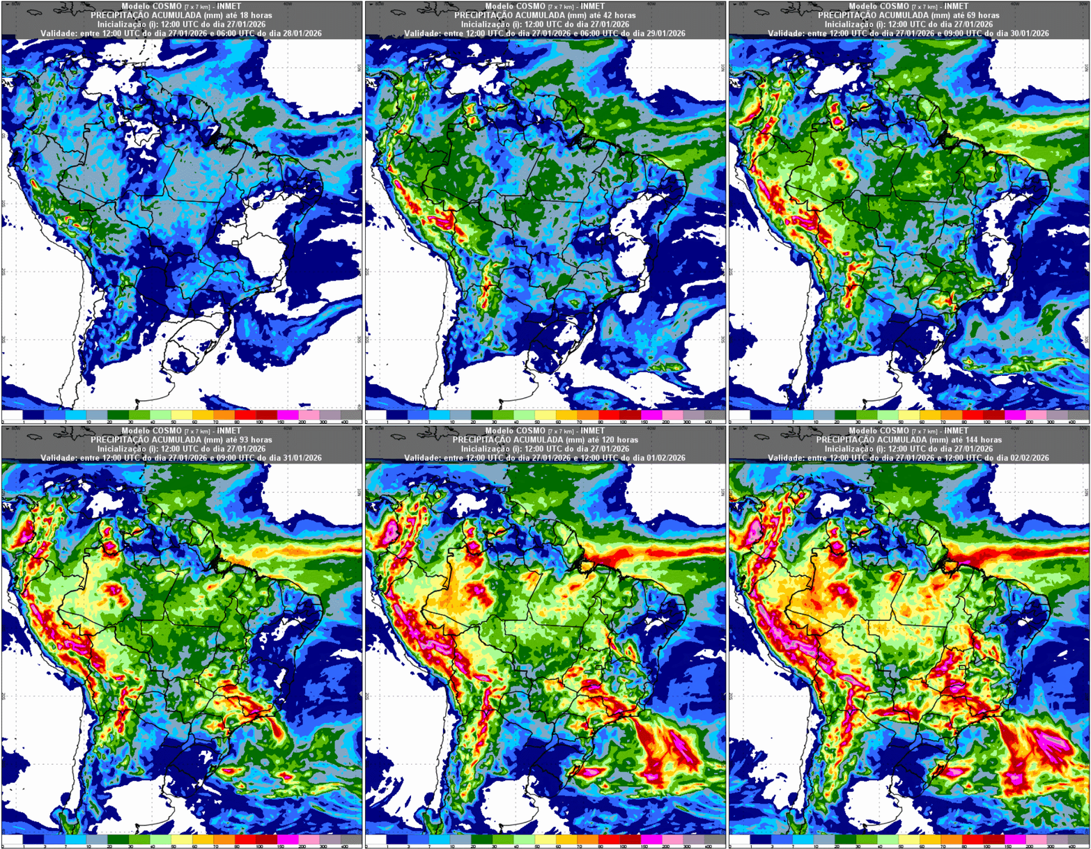
In the Northeast, despite the absence of rain in much of the central area of the region, Inmet (National Institute of Meteorology) is drawing attention to a wetter scenario in western Bahia. The region is expected to register significant rainfall, especially from the weekend onwards, with accumulations between 50 mm and 100 mm, and isolated storms with high volumes in a short period cannot be ruled out. Rain is also forecast for areas of Maranhão and the far west of Piauí, mainly in the first half of the week.
The Northern Region is expected to continue experiencing frequent rainfall, with accumulations between 50 mm and 100 mm, mainly in Acre, western Amazonas, and Pará, as indicated by the more intense shades on the weather maps.
In the Southeast, the scenario requires attention. Between Friday (30) and Saturday (31), rainfall volumes may exceed 120 mm in areas of eastern São Paulo, Vale do Paraíba, southern Minas Gerais — including the Serra da Mantiqueira —, Zona da Mata in Minas Gerais and throughout the state of Rio de Janeiro, increasing the risk of extreme events associated with persistent rain.
In contrast, the Southern Region presents a drier pattern throughout much of the week, especially in the western parts of the states. Despite the possibility of localized rain between the coast of Santa Catarina and eastern Paraná at the end of the week, the predominant weather is stable, a condition that favors higher temperatures.
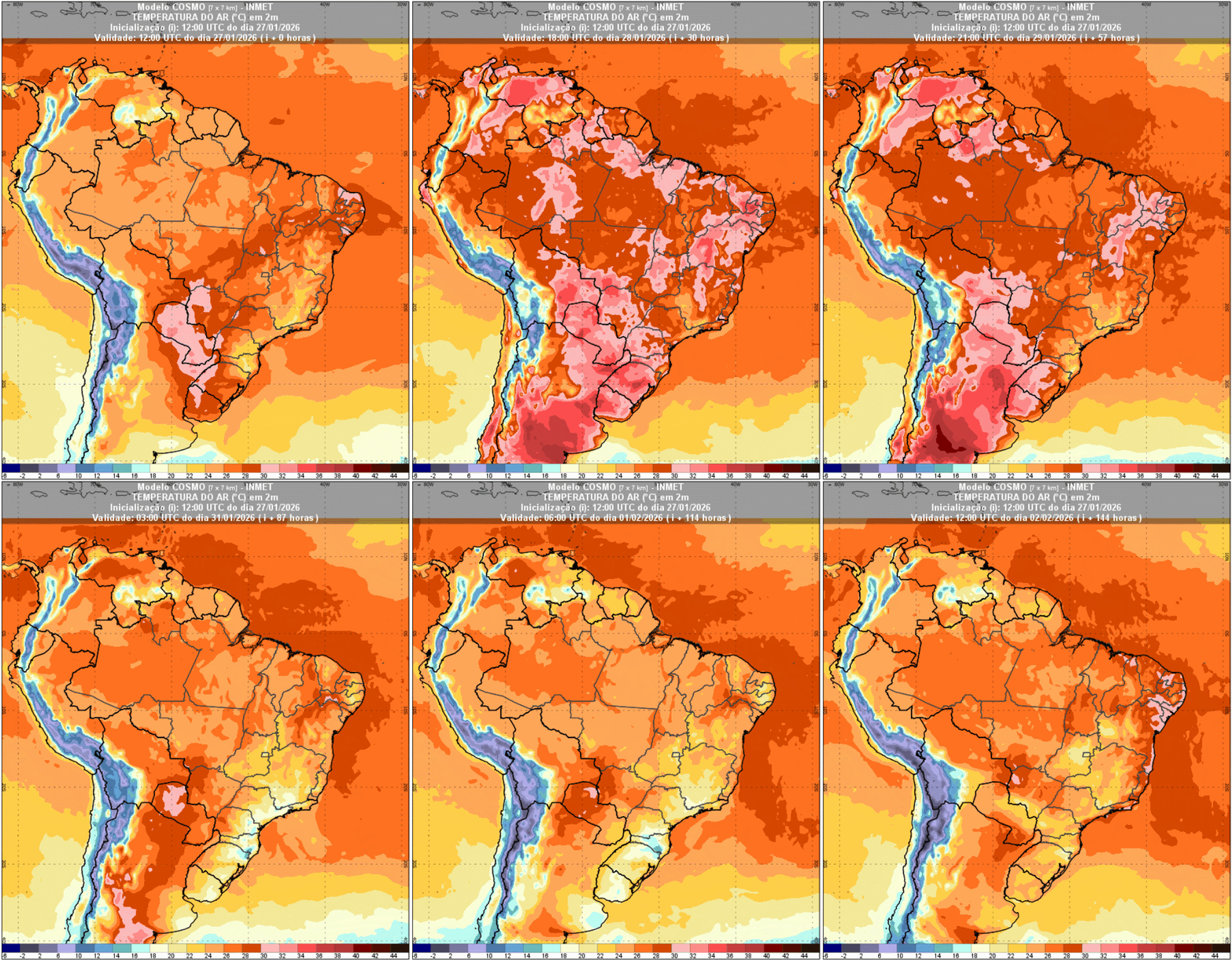
Temperature maps, particularly those for the 28th, show intense heat in the South of the country. Rio Grande do Sul, Santa Catarina, and southern Paraná are expected to register highs between 32°C and 38°C, with values up to 7°C above the historical average for the period. This warming is favored by the presence of a high-pressure system, which inhibits cloud formation and reduces rainfall. In the second half of the week, with the advance of unstable areas, temperatures tend to decline slightly, mainly in the eastern part of the region.
In other regions, heat also predominates in areas of the Midwest and Northeast, with highs above 34 °C in several places, while rainier areas of the Southeast have milder temperatures, reflecting greater cloud cover and persistent rainfall.