EN
 PT_BR

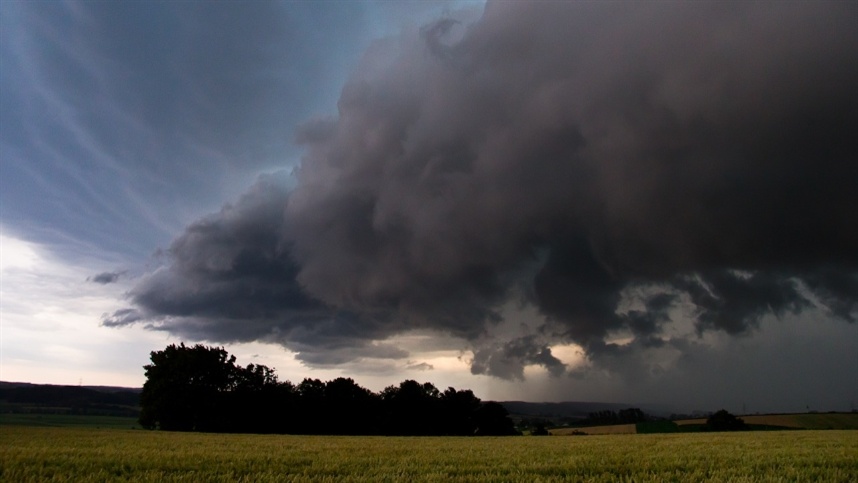
The passage of a cold front associated with an extratropical cyclone should cause intense rains, storms and risk of disruption in areas of the South, Southeast and Midwest of Brazil between Friday (23) and Sunday (25). According to information released by Meteored, the forecast indicates the possibility of accumulations exceeding 100 millimeters in 24 hours in parts of Rio Grande do Sul, Santa Catarina and Paraná, in addition to risks of flooding, flash floods, landslides and hail.
Extreme rainfall puts the South-Central region on alert.
The Extreme Prediction Index (EFI) shows high values for areas in the South-Central region in the coming days. The indicator uses the 99% percentile as a reference, associated with the most intense meteorological events recorded in the recent history of a region.
Values between 0.5 and 0.8 indicate the possibility of unusual events. Above 0.8, the index points to the potential for very unusual or extreme episodes.
According to information released by Meteored, this Friday (23), the forecast indicates unusual events in a strip that runs from southwest Paraná to Rio de Janeiro and east of Minas Gerais.
On Saturday (24), the scenario should intensify, with the possibility of extreme rainfall in the interior of Santa Catarina and Paraná. On Sunday (25), the system advances gradually, but still maintains the risk of intense precipitation in São Paulo, Minas Gerais, Rio de Janeiro and Mato Grosso do Sul.
Friday is forecast to bring thunderstorms to the South and Southeast regions.
The formation of the extratropical cyclone should be completed by the end of the night this Friday (23). Until then, a trough — an elongated area of low atmospheric pressure — favors the convergence of moisture over the Southern Region.
The ECMWF weather model indicates a forecast of heavy rain in the southwest and west of Rio Grande do Sul and in the midwest of Santa Catarina.
In the Southeast, the instability also requires attention. The Paraíba Valley in São Paulo, the state of Rio de Janeiro, Espírito Santo, and the southern and eastern regions of Minas Gerais are subject to intense rainfall and storms accompanied by lightning.
Saturday brings a high risk of extreme rainfall to the South.
On Saturday (24), the extratropical cyclone and the cold front will already be formed over the ocean, with direct influence over the north of Rio Grande do Sul, Santa Catarina and the south-central part of Paraná.
By late morning, the forecast indicates a high potential for storms and significant rainfall in these states. The main risks include flooding, flash floods, landslides, power outages, and hail.
During the afternoon, the unstable weather is expected to spread across Rio Grande do Sul and move into other areas of Paraná. The forecast highlights the Santa Maria region in Rio Grande do Sul, and the area between Joaçaba and Itajaí in Santa Catarina.
According to information released by Meteored, the ECMWF model projects rainfall totals exceeding 100 millimeters in 24 hours in parts of northern Rio Grande do Sul, much of Santa Catarina, and locations in Paraná.
Among the projected volumes are:
- Passo Fundo (RS): 150 mm;
- Concordia (SC): 148 mm;
- Pato Branco (PR): 108 mm.
In the Southeast and Midwest, Saturday should have predominantly overcast skies. In the afternoon, rain is expected to concentrate on the border between São Paulo and Minas Gerais. At night, the first storms may hit Mato Grosso do Sul and southern São Paulo, with gusts of wind.
Sunday maintains risk of storms in the Southeast.
On Sunday (25), the advance of the cold front should allow a gradual reduction in rainfall in part of the Southern Region. Still, there is a forecast of isolated heavy showers in the north of Rio Grande do Sul and in the area between Itajaí, in Santa Catarina, and Londrina, in Paraná.
Attention is primarily focused on the Southeast region. According to ECMWF forecasts released by Meteored, heavy rains and storms may hit large parts of São Paulo and Rio de Janeiro, including the capitals, with a risk of disruption caused by flooding.
In Minas Gerais, areas requiring attention include the south and southwest of the state, the Triângulo Mineiro region, and the Zona da Mata region, where there is also a possibility of thunderstorms.
Central-West region experiences rainfall concentrated in specific areas.
In the Central-West region, the forecast indicates a relatively calmer situation on Sunday, despite the presence of many clouds. The most intense showers are expected to be concentrated in eastern Mato Grosso do Sul and Goiás. In Mato Grosso, light to moderate rainfall is expected.
Even with the gradual movement of the frontal system, the forecast of storms in different regions maintains the need to monitor weather updates and alerts issued by civil protection and defense agencies.